Category: A2Z Challenge

  • Base-map: canvas for a map-maker

    Base-map: canvas for a map-maker

    Do you remember your school days, when your geography teacher would ask you to get some blank outlines of either a map of India or the state about which you are studying that year? It used to be just a blank canvas. Simple plain white paper with outline printed mostly in blue colour. Then the teacher would ask you to mark either some tourist spots, or mineral mines or something of that sort on that map. To tell you the truth, I used to dread those times. Every dot I used to put on that blank paper, my anxiety would pile up. Fear of making the wrong map is real. Sometimes even today, it creeps back into my mind. But, about that, some other time. Let’s know more about this canvas of us map-makers; base-map.

    Base-map: a chance to start a fresh

    However, my interest in maps increased as time passed and I decided to be a map-maker. When I was studying map-making, that dreadful thing in my school days got introduced to me as a “base-map” on which a map-maker builds his or her version of the world. It always acts as a blank canvas to start a new story. Sometimes, it may be about the way to travel from one place to the other. While some stories may tell you about what particular region eats as their staple food. You can tell any story with this blank canvas.

    India Administrative Outline: Copyright – Maps of India
    Maharashtra District Outline: Copyright – d-maps

    Nowadays, with the advancement of technology, even maps have gone digital. These days, we make maps on online platforms. It gives us a chance to play with our canvas. Why have only plain white canvas to work with? You can add colour, texture and funk to your story right from the base maps. Let me show some funky designs I made to use as a base map. I am still the story to tell on that design.

    Don’t let the labels, roads and colours on this map fool you. This is just the base-map. It doesn’t tell any story as it is. It just shows a core part of Pune City in India. But if I start adding data on a particular theme or subject on this, say old temples in the city, or schools or hospitals, then it will be a meaningful map. When you open a map on your phone, it shows a map with a bunch of landmarks on it. Unless you search something in particular, or start the navigation function, technically it’s just a base-map. Depending on the purpose of the map, a base-map can be anything from a blank outline to a funky, colourful map with some data-points on it.

    Would you like to tell a story on this canvas? Let me know in the comment section below.


    I’m participating in #BlogchatterA2Z. You can read my other posts about maps and map-reading here.

  • Let’s start with A of Map-reader’s ABC

    Let’s start with A of Map-reader’s ABC

    Since the widespread use of smartphones, one thing which has improved is commuting between new places. Exploring unknown areas, visiting new cities and towns around the globe is now easy. Google maps and apple maps are one of the most used apps in our lives. “Please share your current location and I will reach you.” “Sir, location sahi hai na?” “Mam, address nahi mil raha, please pin bhejo na.” These dialogues are now very common in our day-to-day life. But, these are not the only maps and using other maps can also be fun. Today, I am starting to write a series about maps and how to read them.

    Map-reading? Wo kya hota hai?

    I have been working as a map-maker since 2012. Making these different maps is fun work. I get a chance to know a lot of things which otherwise I would not. But one thing I have observed is that the general public is missing the fun of using maps. When we start our course in development planning at CDSA, Pune, we organize a fun Treasure Hunts in some parts of the city. I have witnessed students getting confused if we hand them over some printed maps and ask them to come to a particular location. Opening a paper map from books or atlas used to be a fun part of my childhood. However, now it seems people are more and more relying on gadgets.

    So, map-reading is a basic skill which helps you to use the piece of paper on which location information is printed and reach your destination or have an understanding about a particular issue.

    I would like to take this opportunity and introduce you all to the fun part of maps and map-reading. Hope by the end of this month, you all would love to get a map out and get on with your own adventure.

    Let’s start with A of Map-reader’s ABC

    Today, I will tell you the basics which make any diagram into a map. There are four key components without which, map is incomplete.

    • Orientation
    • Scale
    • Title
    • Legend / list of symbols

    Orientation:

    Orientation is the most important factor of any map which allows its user / reader to align him/herself with its surroundings. In the world of map-making, a norm has been set. Every map will have a North direction towards the top side of the paper or screen. However, this is a very recent standard which has been set during the glorious days of maritime trade and explorations. Seafarers felt the importance of magnetic north and started this practice. Before that, European map makers used to orient their maps to the East as direction towards the holy city of Jerusalem. The word itself is derived from “Oriens”, a Latin word for East.

    A map of New Netherlands and New England created by Dutch cartographer Willem Blaeu has a west orientation, 1635.

    Cartographers, guys who make maps, who went to the New world like Willem Blaeu, oriented their maps toward the west and Japanese map-makers during the 17th and 18th centuries didn’t even have standard orientation. Just imagine the headache it would give to its readers. For you to understand this, do one thing. Open google or apple maps in your friend’s phone and rotate the map using two fingers to some random angle and give it back. Then ask your friend to understand the lay of land! It would be fun to watch the expression on his or her face!

    So, keep in mind, in modern maps, North is at the top. Mostly!

    Scale

    Scale is the measure which allows the reader to get an idea about the distances between places on a map. Generally scales are mentioned at the bottom left corner of the map. You will find a graduated scale or a ratio of numbers. Scale depicts the distance on paper to the corresponding distance on the ground. For example, if the scale is 1:24,000, then 1 cm on the map will be 24,000 cm on the ground.

    Map made by CDSA, Pune

    Title

    Title of the map gives you an idea about the story that map is telling you. In the above map, title “Water availability at villages in Bhadwad Level 3 cluster” gives a clear idea about things shown in the map. Generally they are put in bold letters and at the top. However, some maps may show it in a much fancy way like Blaeu’s map of New Netherlands.

    Legend / List of Symbols

    Map is a colourful document full of various symbols and patterns. They have a specific meaning depicting various information points about that particular place. For ease of reader, these symbols, colors and patterns are explained in a form of a list. (Mostly on bottom right corner of the map, just like in the map above)

    Sometimes, a map is provided with additional information, notes and other details but comes as a bonus. For you to call a map, a map, these four things are must. So, with these four things in our mind, let’s start our wonderful journey of reading maps. Hope you will enjoy the time with me this month. Waiting for your response in the comments below.


    I’m participating in #BlogchatterA2Z. You can read my other posts about maps and map-reading here.
  • What’s for BlogchatterA2Z? – Theme Reveal Post

    What’s for BlogchatterA2Z? – Theme Reveal Post

    April is that time of the year when your skill of consistent writing is put to the test. It’s time for the April A2Z campaign hosted by Blogchatter. 2022 is my fourth year after my successful stint in April 2021. Last year’s campaign was a boon for me. It gave me my first eBook Incredible India Bucket List, which is available on Blogchatter bookshelf for you all to read. This post is to tell you the theme I chose for the campaign of 2022.

    Marrying passion with profession for theme for 2022

    I have been working at the Centre for Development Studies and Activities, Pune for the past 7 and half years. We work in the development planning sector with sustainability as our core value. I work as a mapmaker in our institute. I enjoy every bit of my work as a map maker. We have prepared some interesting maps working with the urban data in the past 3-4 years of our Quantified Cities Movement. Through year’s theme, I am trying to create a “Pocketbook for Map-reader” during Blogchatter A2Z. Hope you will enjoy reading the maps by the end of April 2022 and who knows, start using some in your own work.

    Adi’s Journal A2Z theme

    Pocketbook of Map-reader

    I will take you all on a journey of map-reading. I will explain the basics of map reading, talk about various types of map we make. How the maps evolved over the time with some fun facts about map making. Rest assure, A2Z posts are going to be a fun read. I won’t bore you with technical details!

    I wish you all a great month of blogging ahead. Also, I am excited to read what you guys will be creating. Hope you will enjoy this series and shower your love on this too, just like the last year.

    Blogchatter A2Z Calendar

    I’m participating in #BlogchatterA2Z.

  • Ziro Valley – A Heaven from North-East

    Ziro Valley – A Heaven from North-East

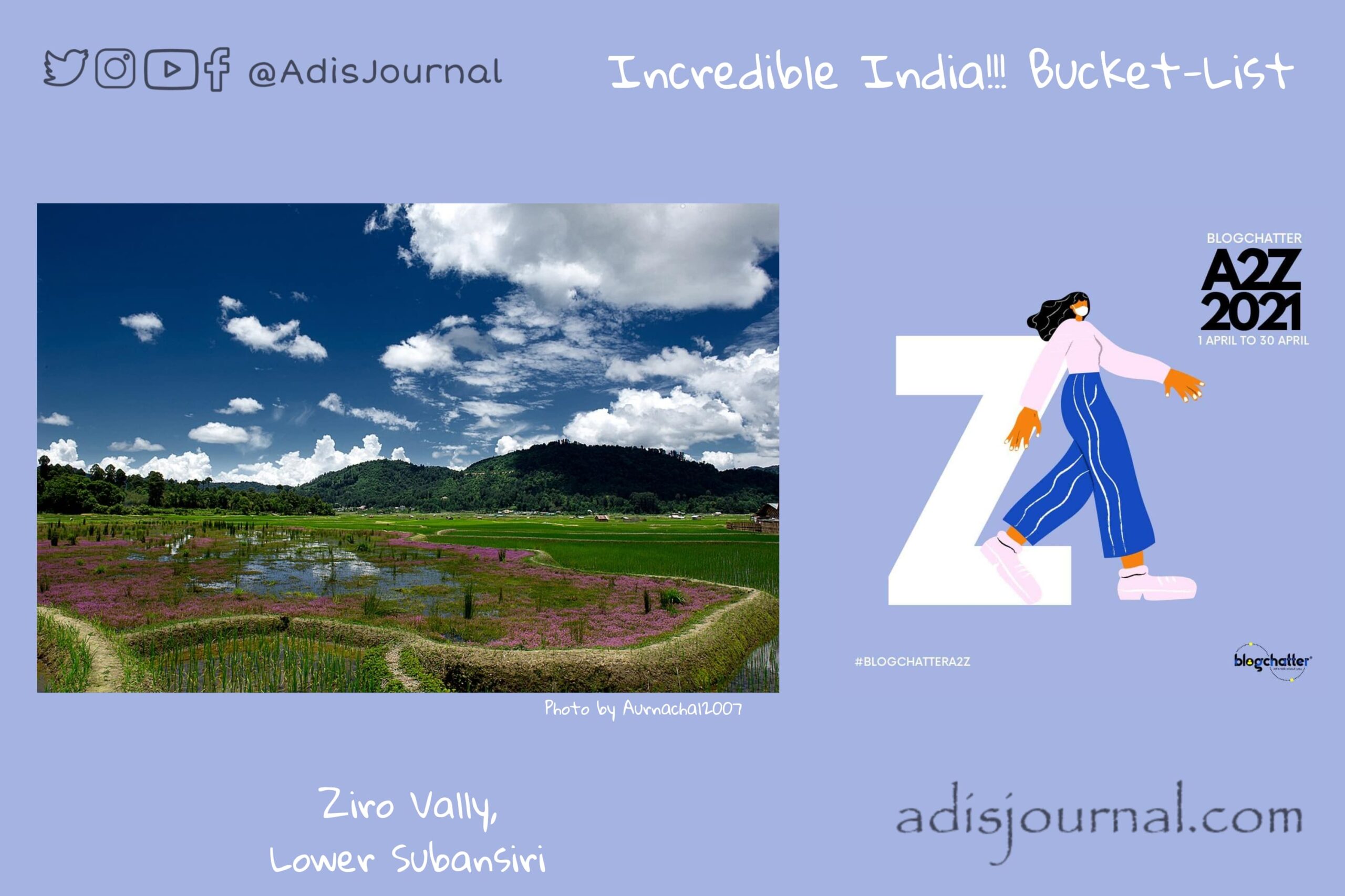
    North-Eastern India is blessed with the sheer beauty of nature. Small towns and villages snuggled in valleys of Himalaya are little heavens on earth. Today we are visiting one such heaven in Arunachal Pradesh. Ziro Valley, a heavenly town in Lower Subansiri District.

    About Ziro Valley

    Ziro is a district headquarters of Lower Subansiri District. It is one of the oldest towns of Arunachal Pradesh. Rice fields surround this small yet beautiful hill station. The town of Ziro is nestled between a cluster of beautiful pine trees. This plateau is at an altitude of 1500 m above sea level. As a result, Ziro is full of a distinguished and rich flora and fauna and its biodiversity. This makes it an ideal destination for nature lovers. Thick forest covers this entire region and is a home to tribal people.

    The ApaTani tribe which calls these lands as their home is not a nomadic tribe, practicing permanent wetland agriculture. This is very different from the prevalent jhoom farming. Other than wetland farming, they earn their livelihood by making handicrafts and handloom products. They worship nature gods. The tribe is known for their colorful culture with various festivals. Apa Tani people have vibrant traditional village councils called bulyañ. This has made Ziro Valley a good example of a living cultural landscape where man and environment have harmoniously existed together in a state of interdependence even through changing times, such co-existence being nurtured by the traditional customs and spiritual belief systems.

    Gallery

    Tourist attractions

    The major tourist attractions of Ziro are the green serene Talley Valley, the hillock Ziro Putu, Tarin fish farm, the tall idol of Shiva Lingam at Kardo. ApaTani people celebrte several festivals namely the Myoko Festival in March, the Murung Festival in January and the Dree Festival in July.

    Ziro is also known for its outdoor music festival. First festival happened in the year 2012. Members of the ApaTani tribe host this festival. Festival celebrates the independent music scene of India. Festival is celebrated on two stages, Donyi(Sun) and Polo(Moon), constructed by local artisans and made almost completely of bamboo. As a result, it is noted to be one of the most eco-friendly festivals in India employing locally sourced material for the infrastructure. The festival has a zero plastic policy and encourages attendees to be responsible for leaving behind no waste.


    I am participating in the A2Z challenge with Blogchatter and this is my take on the ‘Z’ challenge. “Z is for the Ziro Valley, Lower Subansiri, Arunachal Pradesh”. You can find my other posts from this challenge here.

  • Yamunotri – Birthplace of the River Yamuna

    Yamunotri – Birthplace of the River Yamuna

    Indian culture puts rivers at the place of goddesses and worship them. India People celebrate every river and worship them. Today we are visiting the birthplace of one of the holiest rivers in India, Yamunotri: Birthplace of the River Yamuna.

    Personification of River Yamuna Photo by I Sailko Copyrights CC BY-SA 3.0

    Stories of the Yamuna

    According to Hindu beliefs, there are many stories associated with this river. These stories are in connections with many gods like Shiva, Surya, Krishna etc. River Yamuna is mentioned several times in the Rigveda, Atharvaveda, Aitareya Brahmana, Shatapatha Brahmana and many Puranas. Goddess Yamuna beares other names as Yami and Kalindi. Yami is a twin sister of god Yama, the God of Death and daughter of the sun god Surya. These relations gave her the name Yami and Yamuna.

    However, for the name Kalindi, there are many stories. One of them is related to lord Shiva. Distraught by the death of his wife Sati, Shiva wandered the whole universe. The god of love Kamadeva shot Shiva with the arrow Unmadastra, that made Shiva restless and excited.  He jumped in the river Yamuna to overcome his urges. While bathing in the river Yamuna, the river turned black because of Shiva’s sorrow and unfulfilled desire. Another story describes the story of the banishment of serpent Kaliya in the Yamuna. As the black serpent entered the river, it turned black.

    Shrine of Yamunotri

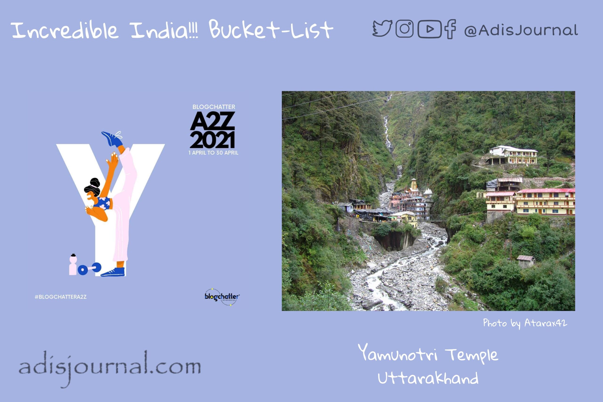
    Shrine of the River Goddess Yamuna is situated at an altitude of 3,291 metres (10,797 ft) in Uttarkashi district, Uttarakhand. You can reach the shrine by hiking on several routes. One of them starts from Janaki Chatti and a couple of them goes from Hanuman Chatti. This temple is a part of India’s Chota Char Dham pilgrimage. The temple of Yamunotri got destroyed twice by snow and floods. However, after every incidence, people rebuilt the temple again. Maharani Guleria of Jaipur re-built the Yamunotri temple in the 19th century. There are two hot springs near the temple. The temple and place opens every year on the auspicious day of the Akshaya Tritiya and continues to be open till Yama Dwitiya in Diwali.

    Yamunotri Temple built by Maharani Guleria of Jaipur in the 19th century- Photo by JediPro Copyrights CC BY-SA 3.0

    I am participating in the A2Z challenge with Blogchatter and this is my take on the ‘Y’ challenge. “Y is for the Yamunotri Temple, Uttarkashi”. You can find my other posts from this challenge here.

  • Xuan Zang Memorial Hall – Honoring the travelling wisdom seeker

    Xuan Zang Memorial Hall – Honoring the travelling wisdom seeker

    Medieval India attracted a lot of foreign travelers from all around the world. They documented their experiences in chronicles for the coming generations to read and enjoy the travelling experience in both time and space through their eyes. Today we are visiting a memorial hall built in honor of one such traveler. Xuan Zang Memorial Hall built in Nav Nalanda Mahavihara.

    Japanese painting of Xuan Zang from Kamakura Period

    Story of Xuan Zang

    Xuanzang, commonly known as Hiuen Tsang in India, was a Chinese Buddhist traveller, travelling through India in search of the ultimate wisdom that India has to offer. He travelled extensively across the length and breadth of the subcontinent. Xuan Zang came in from Khyber Pass and travelled south-eastwards visiting Stupas and Viharas around Peshawar, Oḍḍiyāna, Ruins of Taxila, Kashmir, places in Punjab, Himachal Pradesh and then crossed the River Yamuna and reached Mathura. He continued his travels until he reached Nalanda with some local monks. He stayed in Nalanda studying about buddhist philosophy for about two years. During this time, Xuanzang studied logic, grammar, Sanskrit, and the Yogacara school of Buddhism. 

    After this, he started his journey south and travelled towards Andhra Pradesh. He visited viharas at Amaravati and Nagarjunakonda and studied more about Buddhism. He continued traveling to Nasik, Ajanta, Malwa; from there he went to Multan and Pravata before returning to Nalanda again. After a short stay in the area of Sylhet, Kamapura and Prayag, Xuan Zang returned to China via Khyber pass through Kashgar, Khotan, and Dunhuang. Chinese people celebrated his return after 16 years with a great procession.

    Story of the memorial

    Bhikkhu Jagadish Kashyap, the founder Director of Nava Nalanda Mahavihara first proposed the establishment of a Memorial Hall as a symbol of Indo-China friendship dedicated to the great Monk, scholar Ven Xuanzang. He believed this memorial will serve as homage to Xuanzang’s spirit of freedom and quest of knowledge. Hall was established on the southern bank of Padmapushkarni Lake in 1957 where the Government of India received the relics of Ven. Xuanzang along with an endowment for the construction of the Xuanzang Memorial Hall and some Chinese Buddhist texts.

    There were repeated requests for renovation. Even various plans were drawn. However, only in 2007, renovation and reconstruction of the memorial is done. Today we can see a renovated and refurbished memorial hall housing these relics and texts. Hall shows a mix of Chinese and Indian architecture with classic sloping curved roofs with blue tile. People believe that curved lines ward off the evil spirits who only travel in straight lines. Rich red color depicts joy and happiness and keeps ghosts away. Chinese and Indian cultural elements are woven in the building and they create a peaceful environment.

    Xuan Zang Memorial Hall Nalanda – Photo by Tabish Q –
    Copyrights CC BY-SA 3.0

    I am participating in the A2Z challenge with Blogchatter and this is my take on the ‘X’ challenge. “X is for the Xuan Zang Memorial Hall, Nalanda”. You can find my other posts from this challenge here.